At http://phys.org/print377424373.html … a series of shots of the ice cap growing and receding during the Late Glacial Maximum is illuminating. It relies on collated data – which is based on certain geological assumptions but never the less it does provide us with a view of how the ice cap grew – and then subsided (over time).
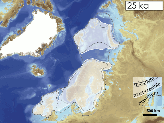 A vast ice sheet spread across Scandinavia into northern Russia in the east, the Barents Sea in the NW, and Britain and Ireland in the SW. The geologists have used a series of images of the ice group and then embedded them together in order to create the moving ice sheet you can see above. The time scale is said to be 40,000 to 10,000 years ago (roughly so) but no reason is provided for the growth and decline.
At its largest extent the ice sheet extended to the continental shelf off the western coast of Ireland, around 23,000 years ago. However, it seems it took another 700 years before sice reached its maximum extent in northern Russia (just before the end of the Ice Age). The press release ends by telling us there are still uncertainties in the data – so expect updates at some stage in the future.