This is one of those stories that I find fascinating, a man that has devoted a great deal of his spare time and holidays in investigating an archaeological oddity, walking and hiking for miles in an attempt to understand what might have been going on. Obviously, as the evidence mounts one has to home in some kind of clue, and in this instance he thought he had found evidence of an astro-archaeological alignment. The story is at www.courant.com/news/connecticut/hc-hammonasset-line-solstice-1215-20101220,0,5056454.story .. the Hartford Courant records that a resident of Madison thinks he has discovered a Native American astronomical alignment – marking winter solstice sunrise. It begins in a chamber on the edge of a reservoir, where a piece of white rock is illuminated each summer solstice (in June) in the shape of a dagger. Elsewhere in Madison he has found a piece of land with stone walls he says are aligned to the solstice event – rocks in the shape of serpents, white quartz boulders, prayer seats, and cairns (or heaps of stones).
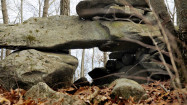
They are among thousands discovered by a retired engineer along what he calls the Hammonasset Line that runs between Council Rock on Long Island, across the Sound, through Madison and Killingworth, NW through the Berkshires, and into the Catskills. He thinks these stones date back thousands of years and were built to mark summer and winter solstice – for what particular purpose is unknown. I suspect he is influenced by the so called alignments at Stonehenge – or those that are generally accepted as real. This is because, as expected, the word Stonehenge crops up – and it is assumed it had an astronomical function. Tom Paul has spent years travelling and hiking along the line and has documented cairns, observation platforms, stone structures, prayer seats and rock piles built to resemble turtles and snakes. On a compass the solstice line follows 318.5 degrees NW and travels across the headwaters of the Delaware River, Lake Ontario in New York State, Lake Huron in Michigan and Manitoulin Island in Canada. The different stone constructions seem to align with each other and possibly with events in the sky or on the horizon, and are according to the New England Antiquities Research Association, worth recording for posterity. The Association studies and tries to preserve stone structures as a way of understanding the historic and prehistoric past and are not averse to associating them with NE native tribes. Whereas perishable artifacts are not preserved in the climate of New England and ploughing has probably destroyed a good deal of evidence, the use of mapping and plotting such structures is considered important and has been useful in deciding if an alighnment exists – or existed. Professional archaeologists were not as supportive. One asked – what need would Native Americans have for such an alignment? (not what does such an alignment means). This negative approach may mean Tom Paul's efforts were in vain as far as the long term is concerned – but who knows.